Q3 update 1
New features Q3, message 1
We start Q3 with another full release message. Over the past month, we have been working hard on Streamline, and we are getting close to a version that can be tested with users. For the web and the current app, we have released the folzowing items in the past weeks:
- It is now possible to draw a measuring point in relation to a fixed point in the app. This means you can select a fixed point on the map and then measure your measuring point in relation to that point, capturing the shift from that point. The fixed point is saved among different measuring points, so you can reuse the same point to measure multiple points. At the bottom of the message, there is a screenshot showing how this function looks and works in the app.
- Update to the DOV export. Now, the precision codes of X, Y, and Z coordinates are also added if they have been filled in Terraindex.
- You can now zoom in and drag the borehole preview on the screen.
Bugs:
- The export of TEQ substances was not correct under specific circumstances. This has been resolved.
- The progress calculation of certain reports could exceed 100%, which sometimes prevented the report from being downloaded. This has been fixed.
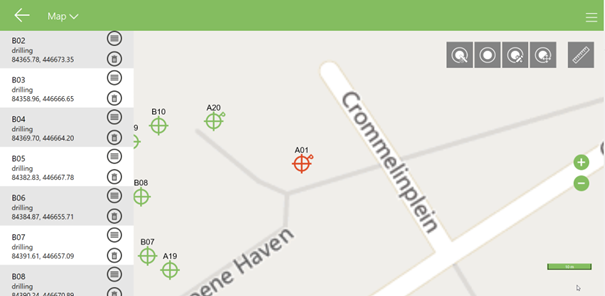
Drawing in a coordinate in the app:
If you open the map in the app now, the following icon has been added in the top right corner.
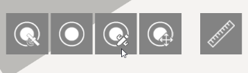
When you click on this, the next menu appears from the right. Through "(Re)draw raster" you can place a grid in the app.
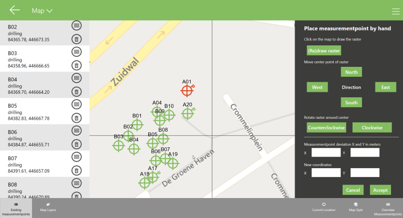
Next, the grid can be rotated or precisely moved using the buttons. North - South - West - East Now, fill in the deviation of the measuring point, the distance over the x-axis, and the y-axis where your measuring point is located. In the example, you can see a point that has a displacement of 5 meters in both the x and y coordinates.
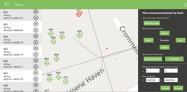
By pressing "accept," the measuring point will be placed at the new coordinates.